Old Ore Road
SOMEWHERE IN THE LOWER BIG BEND:
A photograph portrays only the faintest representation of the subject within the frame, and this truism is no more evident than when taking in the vastness of this secretive land.
The starkness of the mountain ranges and desert, the kaleidoscope of earth tones splashed with the greens and blues of cacti, brush and sky are often too much for the camera lens. This marked lacking brings on frustration at times, until the photographer realizes his effort is best served as a initiator for the memory, and of another place and time.
Yet there is still much to be learned within those confines, if the picture is properly studied. Much like the land itself, first glances can be so deceiving and unyielding in information. One cannot just look, but must open their mind and senses and see what is too often hidden in plain view.
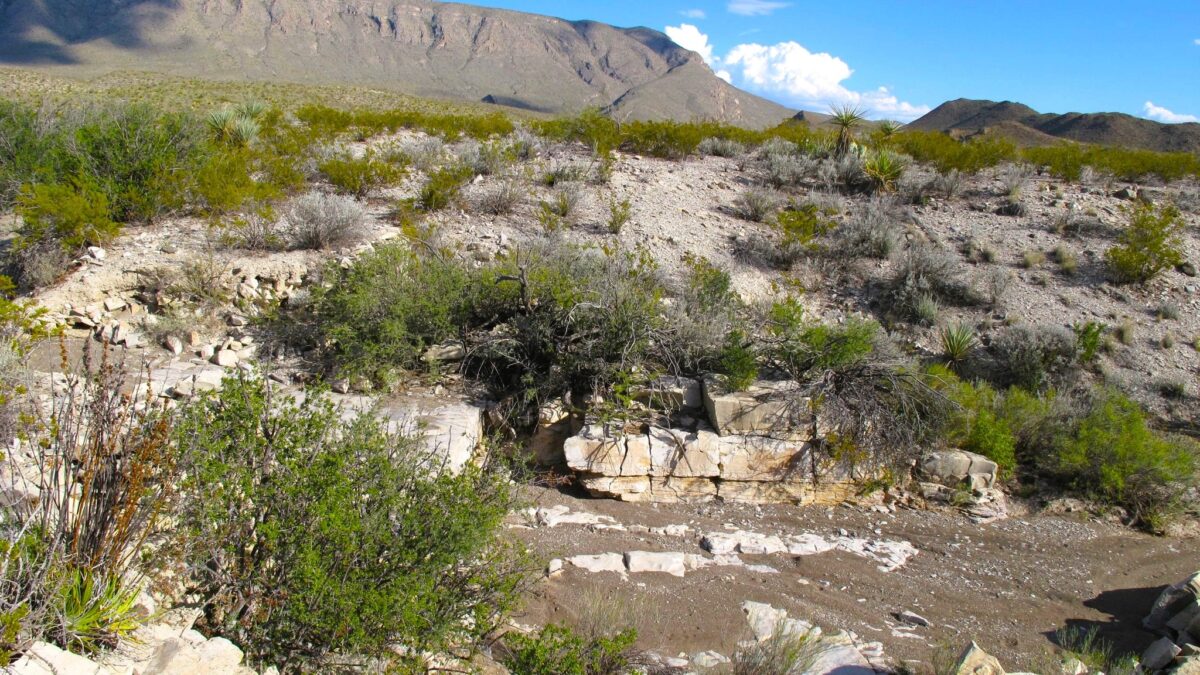
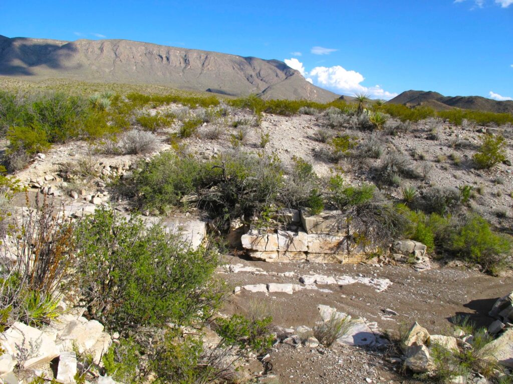
Such is the case with this particular photograph, for it contains a good deal of history.
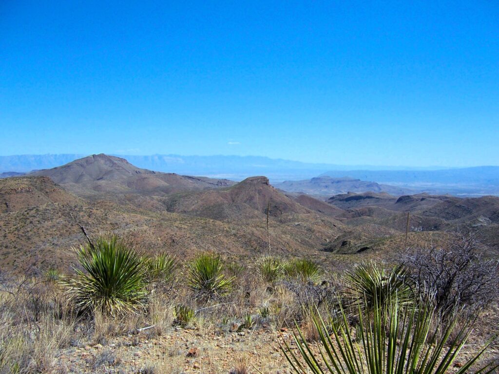
Many who come to the national park have heard of the Old Ore Road, and many have traveled at least a portion of its length. But most never realize parts of the road were abandoned after the NPS took possession of this country.
Once traveling from the north terminal for the overheard ore tramway, the route ran the length of Ernst Basin and across the southernmost slopes of Alto Relex, joining with the present ‘Old Ore Road’ near Willow Tank.
After snaking through this natural chokepoint the route split away again at the Telephone Canyon campsites, continuing near due north until intersecting with the present road once more about a mile and a half south of Javelina Wash.
The original parts were built with real care and thought to their construction, as the route was designed specifically to carry the heavy loads of raw ore to the railhead in Marathon. Though long abandoned and now yielding at a quickening rate to the surrounding desert, these remaining vestiges still give visual testimony to its intended purpose.
Within this frame you can see where a bridge made of native rock and large drainage pipes once existed. The crossing was swept away decades ago by raging flash floods, but walls of stacked flat rocks and small boulders still brace the approaches.
In the distance the viewer can discern the makings of a pass between the Dead Horse Mountains and McKinney Hills. The road travels through there, past the Chief Norton diggings and on to the northern end of Alto Relex. These days the remnants of this road serve as an entry way to certain points along both those ranges, though travel is now only by foot.
Walk respectfully when you wander this way, for you walk an enduring path courtesy of the efforts of strong, willful men now long dead.
This is their memorial.
God bless to all,
Ben
Ben H. English
Alpine, Texas
USMC: 1976-1983
THP: 1986-2008
HS Teacher: 2008-2010
Author 2017-Present
Facebook: Ben H. English
Webpage: benhenglish.com
‘Graying but still game’